
HOME TRAVEL LOG MOUNTAIN BIKING WINDSURFING STORY ARCHIVES RV INFO PHOTOS CONTACT US
HOME
TRAVEL LOG
MOUNTAIN BIKING
WINDSURFING
STORY ARCHIVES
RV INFO
PHOTOS
CONTACT US
< previous story home next story >
Featuring springtime rides in Texas, Louisiana, and Arkansas.
March thru May, 2010
PREFACE
If you enjoy epic rides and/or epic posts, this ode's for you.
![]() I hope you enjoy my story (not literally an ode) of the season we just
concluded.
I hope you enjoy my story (not literally an ode) of the season we just
concluded.
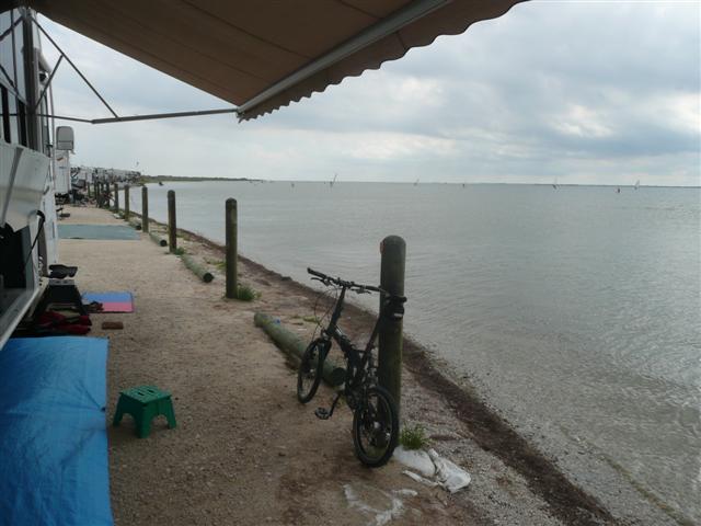
THE BEACH
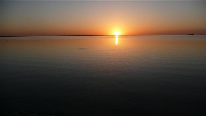
It was a good Spring.
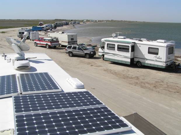
Debbie and I spent almost two months of it on the Padre Island National
Seashore, just south of Corpus Christi on the Texas gulf coast. We've been
full-time RVers for seven years now and this was our third spring spent on the
Laguna Madre.
It's a uniquely cool setup for windsurfing as you can camp right next to where
you sail. The water's warm and shallow, the wind blows nearly every day, and
there are loads of windsurfers to hang out with from all over the US and Canada.
It was great to reunite with old friends and make some new ones.
My mobile office stays connected to the so-called "real world" via satellite
internet and cell phone, and solar power keeps all the electronics humming
silently. When it all works properly, my clients remain blissfully unaware of
exactly where my office is at any given moment...
Typically the wind peaks late in the afternoon, and I spend a few happy hours
trying to make a pig fly. Yes, my poor old Bic board has enjoyed a full life.
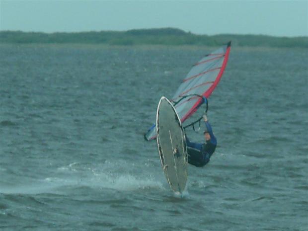
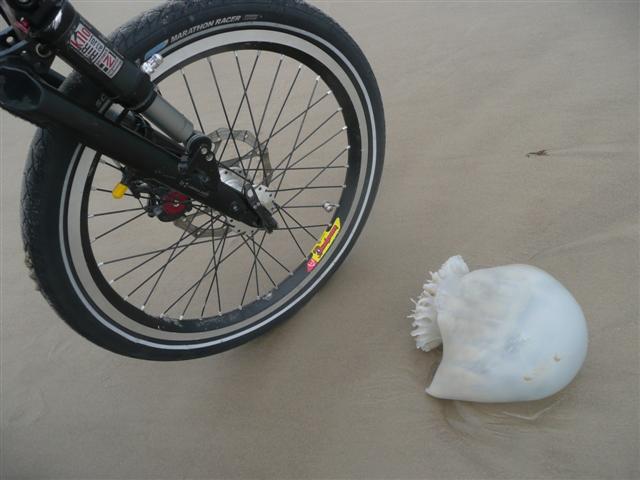
The windsurfing here is fantastic. The mountain biking is non-existent. Dodging
jellyfish on the beach represents the greatest technical challenge.
You might think that the road riding might be good. And you'd be wrong. It's
flat, hot, and windy. About once a week I'd ride a 16-mile circuit through the
park, which I gradually worked my way up from 16.2 mph to 17.4 mph average on.
Yee ha! Well, yawn.
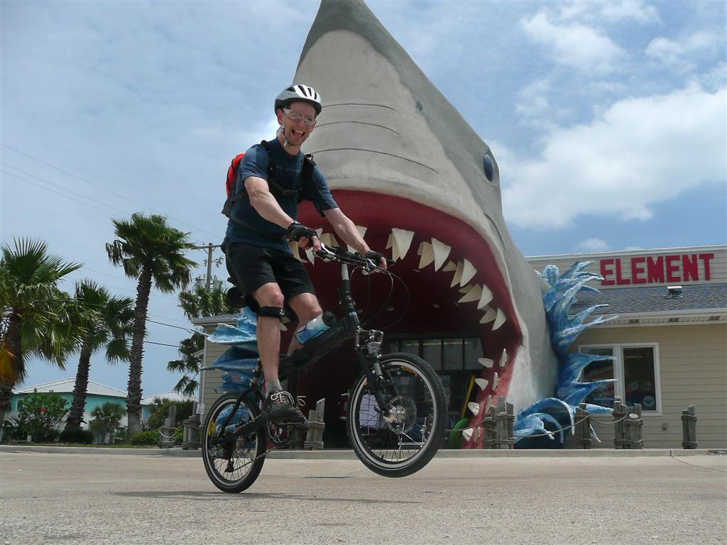
One wind-deprived day I decided to ride to Port Aransas and back, a 65 mile
out-and-back which everyone on the beach thought was pointless at best,
downright stupid at worst. Except for one thrilling encounter with a land-shark,
I have to agree that this was one of my most boring rides ever.
But I had big plans for life after the beach.
Epic plans,
even (if the IMBA is to be believed).
I kept telling myself that such roadie-like behavior would pay off on
The
Womble and at
Syllamo.
By mid-May, it was time to start the transition from windsurf bum back to
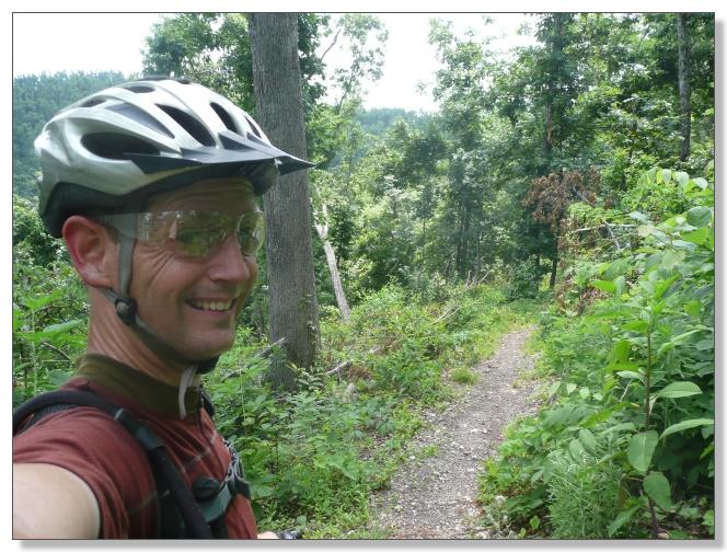
mountain bike bum...
THE CREEKS
We pulled up our (imaginary) anchor and headed back to our home base in
Austin. I made dates with my mountain biking buddies to cram as much trail
riding as possible into one week there.
Walnut Creek is a very convenient couple of miles up the road from where we
stay, and made for a wonderful place to regain a feel for dirt. Three sessions
there were followed by an evening exploration of the surprisingly-compelling
trails of Lakeway, which a friend wanted to check out since he lives nearby and
is keen to get back into riding shape.
Those will work nicely--if they don't kill him.
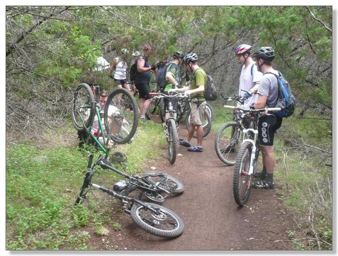
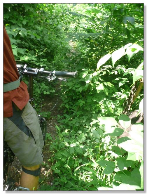
On our last day in Austin, I got a chance to experience one of the infamous
"social pace"
BikeMojo group rides on and around the Barton Creek Greenbelt, led by
well-known exit-row dweller Austin Bike. Unfortunately "mechanical" was the
theme of the day. Fortunately, none involved my folding ride. In fact the 15mm
wrench and patch kit I lug around came in handy to help others more than once.
Sadly, I don't carry any JB Weld and was unable to help mend the small crack
discovered on our leader's Knolly frame. Have to add some to the ole' Camelback
kit, I guess.
![]()
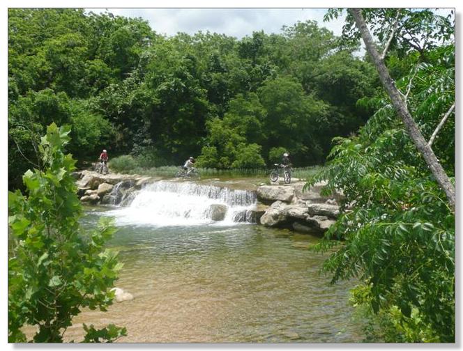
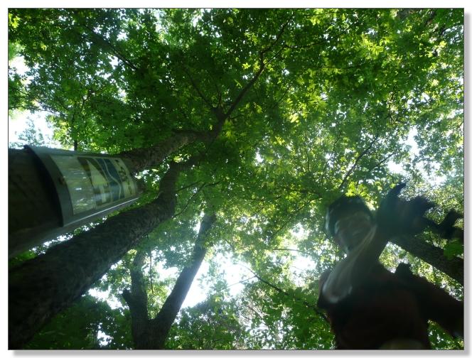
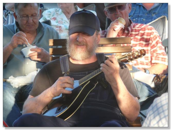
The weather was hot, but the creek was cool, as was the crew and beer
afterwards. Despite the halting nature of the ride, I managed to not crash hard
enough to break myself or the bike, so overall consider it a great ride and
figured I was officially back to real mountain biking form (such as it is, for
me).
THE PINES
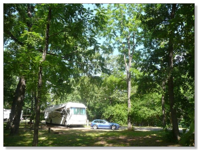
Tyler State Park is deep in the piney woods of east Texas. Its singletrack is
renowned as some of the sweetest in the state, so we worked in an overnight stop
to check it out on our way north.
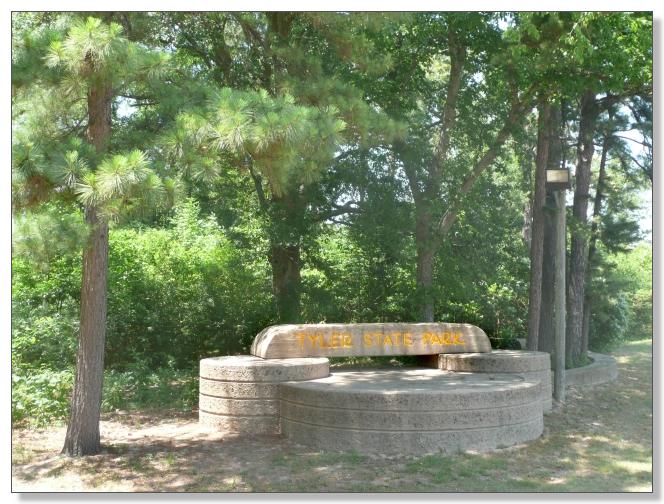
A big part of the attaction here are the nice shady campgrounds which adjoin a
lake. You can hit the trails right from your site.
Debbie joined me for an evening ride the day we arrived. We cruised the
unimaginatively-named loops "A", "B", and "EZ", which represent the easier half
of the network here.
The trail designers had a fair amount of vertical to work, and threw in plenty
of switchbacks keep things interesting.
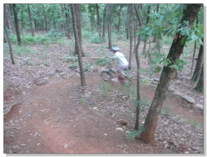
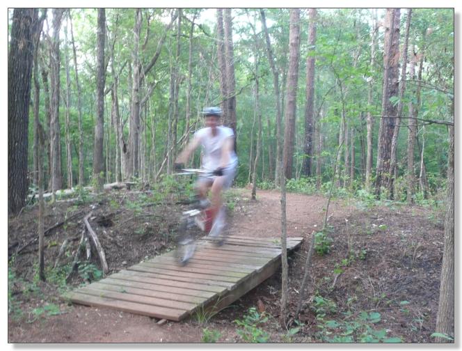
The next morning I did a solo ride to sample the "more difficult" half of
Tyler's trails. Rode "C" and "D" twice--first forward then backwards--then
finished with a backwards tour of "B". That 11-mile route made for a
surprisingly stout workout, with plenty of short but steep climbs, and a good
bit of light technical work thrown in.
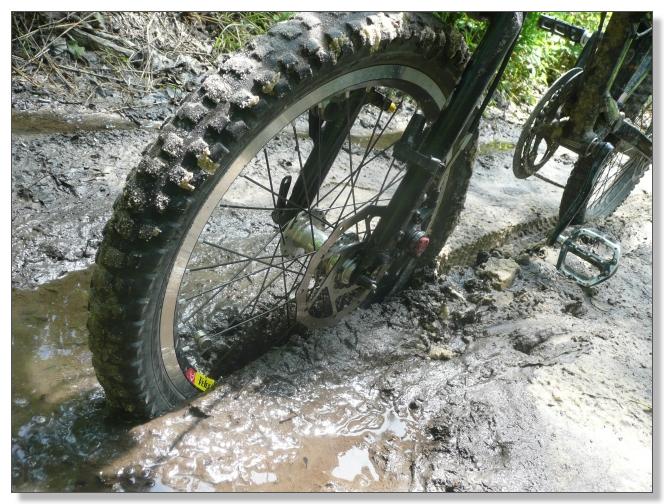
My moving average speed of 6.1 mph on that route was slower than I logged at
Austin's dreaded City Park or San Antonio's chunky Government Canyon, which
surprised me. While Tyler wan't quite as mellow as I had expected (not a bad
thing), I never came close to requiring evacuation. Check out that guy's front
wheel!

Our next stop was an RV service shop in Choudrant, Louisiana for some new rubber
seals. By happy coincidence, Choudrant is barely 10 miles from what is
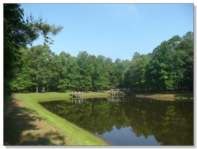
reportedly the best trail system in Louisiana: Lincoln Parish Park in Ruston.
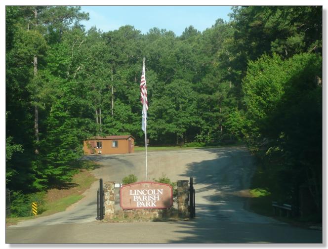
This is an exceedingly well-kept park. Well worth the $1.50 entry fee.
The signage was quite novel. They took Tyler's minimalist naming concept a step
further. To follow the main loop, you just obey the commands given: "TURN
RIGHT", "TURN LEFT", "GO STRAIGHT". No trail names whatsoever. Don't worry about
where you are or where you're going. Just ride.
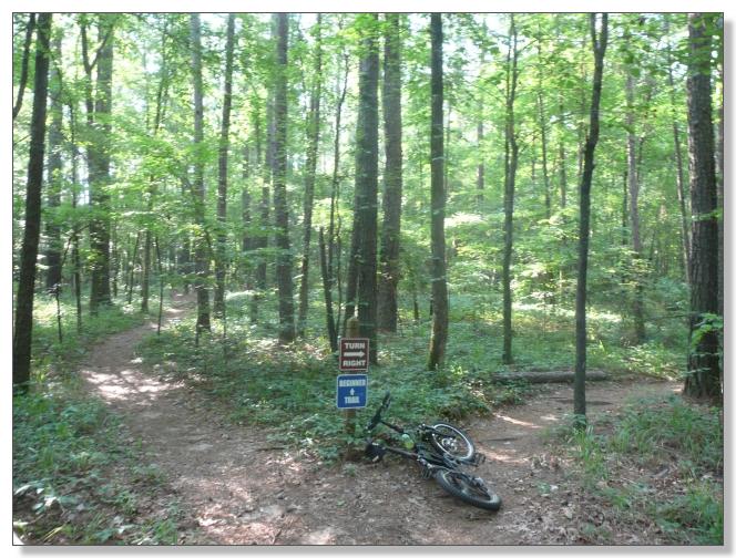
Mountain biking in Louisiana? Well, I will say that Ruston makes the most of the
30-ish feet of vertical available, including several bona-fide steep plunges and
climbs. My favorite part was a series of switchbacks where the trail actually
sloped back down a bit between each turn, to maximize the number of turns
required to summit the slope. Pure gratiuitous fun!
Overall this trail had the coveted "flow" in abundance and I thoroughly enjoyed
it. After finishing the loop, I turned around and rode it backwards, making for
a delightful 20 mile outing. Definitely worth a stop if you ever find yourself
on I-20 in northern Louisiana.
The shop finished our RV while I was riding, so we hit the road and were settled
into the Gulpha Gorge Campground in Hot Springs by that evening. I excitedly
made preparations to get an early start tomorrow. It was going to be a full day.
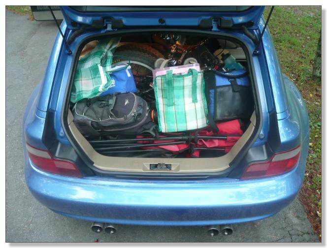
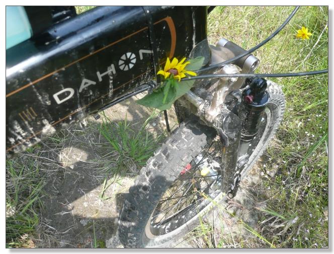
We crammed the hatch full of everything needed for a full day of R & R
(reading and riding). The bike's folded up under all that junk somewhere!
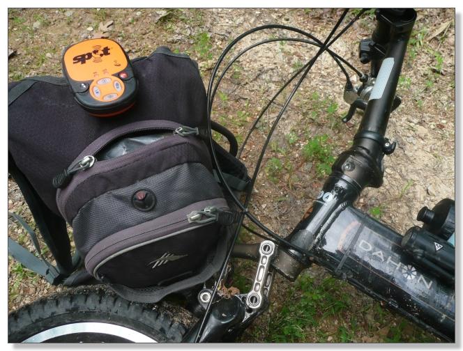
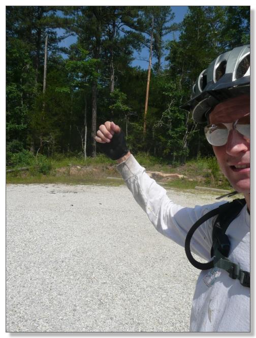
New among the kit was a SPOT personal locator. The SPOT is a sort-of GPS
beacon that transmits via satellite, and therefore works where cell phones
don't. In the event of a life-threatening emergency, you can send an "SOS"
message and a Search and Rescue crew will be dispatched to your GPS
coordinates. It can also be set to send "TRACKING" updates every 10 minutes,
so your progress (or lack thereof) can be monitored over the internet on a
real-time Google Map.
The main purpose of the SPOT however is to send "OK" messages periodically to
reassure your significant other that you're alive and well and having fun. For
some reason Debbie starts to worry when I disappear into the woods for 8
hours...
![]()
(click to see the
SPOT Adventures page I made from all the data collected during the rides
in this post)
Over time, the SPOT should help a lot. But not today, because Debbie would
also be stuck in the boonies (albeit in a car) without reliable phone service
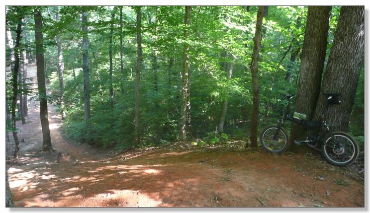
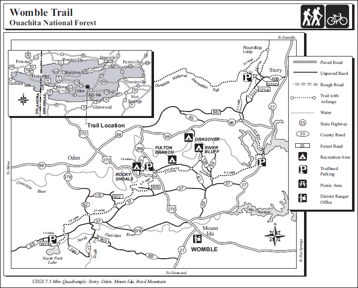
or a computer herself. I started at the Womble's southern terminus of North
Fork Lake, which was reached by following a tricky sequence of
marginally-marked dirt roads. I wished Debbie luck finding her way back out of
the maze, and set off up the trail at about 9:30.
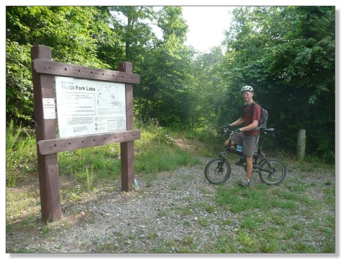
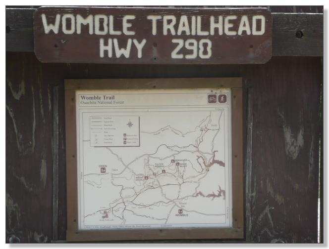
Considering its stature, I was surprised that the Womble lacked a fancy "WOMBLE"
sign at the start, but the trail itself was easy to follow, with white blazes
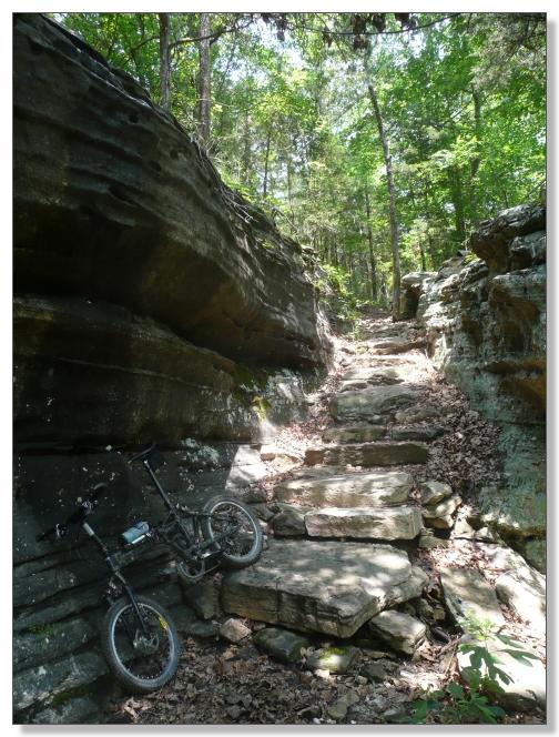
throughout.
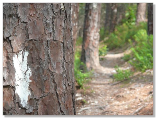
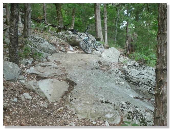
Constructed in the 1930s by the CCC, the Womble was built to last. The soil
has a natural consistency similar to crushed-granite, which makes for mile
after mile of buff singletrack.
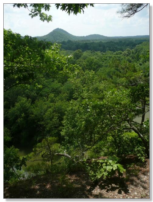
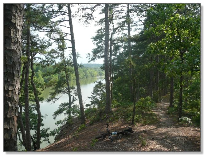
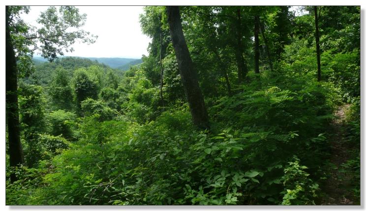
The trail rolls up and down the Ouachitas, with elevations ranging from 1000
to 1600 feet. Sure, these are not the Rockies, but there is plenty of vertical
to accumulate (supposedly 6000' worth, although I think that's high) and
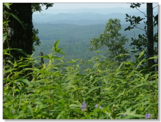
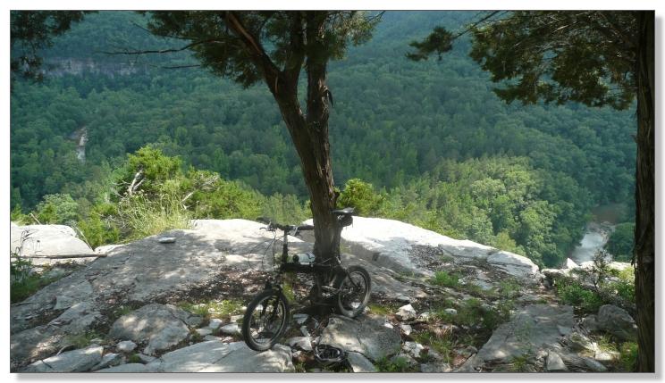
several bona-fide grinders along the way. I took one short side trip early on
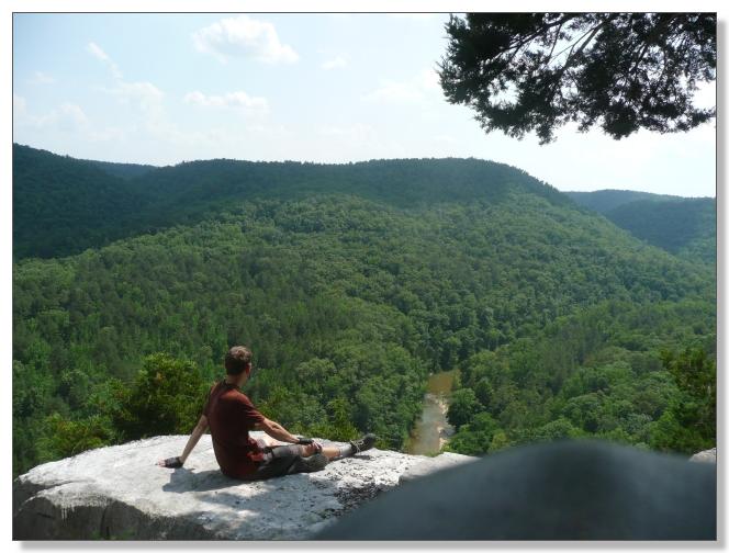
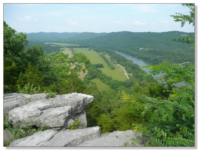
up to the Gaston Mountain "Old" Tower Site. Sure enough, there was no tower to
be seen, but the ridge did provide a good view of the mountains.
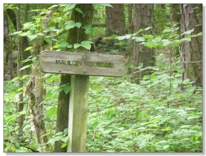
The main event of the first third of the Womble is Mauldin Mountain. A stout
climb earns you a fantastic descent that seems to last forever--as long as the
climb, anyway. Womble magic! The bench-cut is narrow and holds your full
attention for miles on end, despite being essentially non-technical otherwise.
It's not steep, but there's just enough slope to let you go as fast as you
dare with minimal exertion. Outstanding stuff.
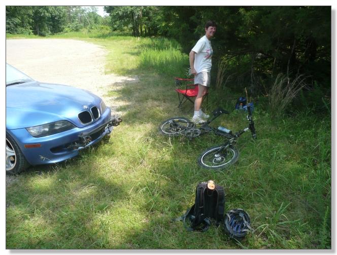
Around noon, and right on schedule, I popped out at the Highway 298 trailhead,
which I noted did have a proper "WOMBLE" sign with that distinctive font.
I was delighted to find Debbie there reading, and she was happy to see me,
because her shade was rapidly disappearing. Although I carried the same
stuffed pack full of food, water, and gear as I usually would for a big ride,
I'll admit it was pretty nice having these "supported" pit stops along
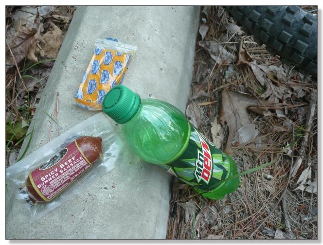
the route. In a downright luxurious move, we even got in the car and had lunch
together, to escape the bugs and enjoy a little air conditioning.
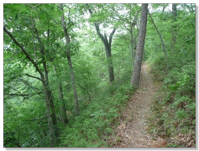
Refreshed, I set off on the middle part of the trail, which is probably the
most popular segment. After a few miles of relatively flat but fun terrain,
the hills return along with more of that fantastic narrow bench cut. You just
zip along, tracking a foot-wide ribbon, traversing hillsides that would turn
out to be "steeper than they look" if you were to lose concentration for a
moment. Stay on target!
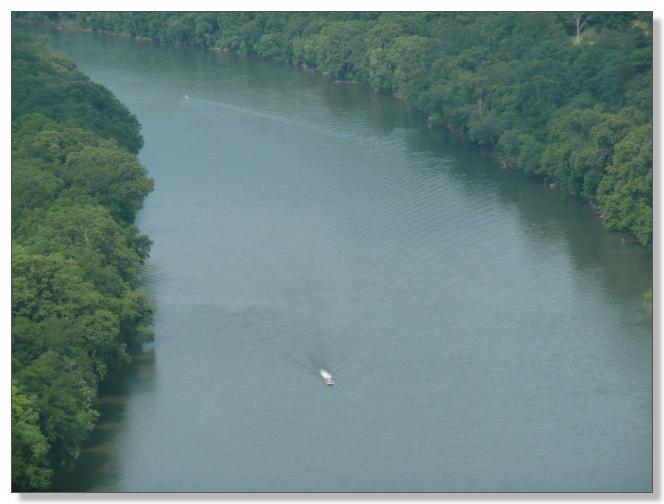
Eventually you come to a short but really steep climb to gain a bluff
overlooking the Ouachita river. Not doing anything too stupid was my
prime directive of the day, and I figured that included overexerting myself in
90+ degree heat trying to make some granny-gear climb I probably couldn't make
anyway, so I just just got off early and pushed that part, which was the only
hike-a-bike of any length of the day.
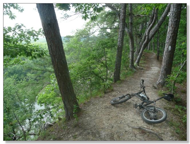
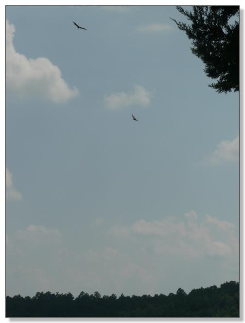
The views up there were really nice, but hard to photograph what with all the
trees in the way. (Cut 'em down!)
The descent from the bluff was short and steep by Womble standards. Fun! This
would be a real grinder of a climb from the other direction, I reckon. You
eventually drop out on a dirt road and it's not totally obvious where you're
supposed to go. I made a few guesses and followed random roads past some
fishing cabins along the lake and soon enough found Debbie parked across the
street from the Highway 27 Fishing Village, more-or-less where I expected her
to be.
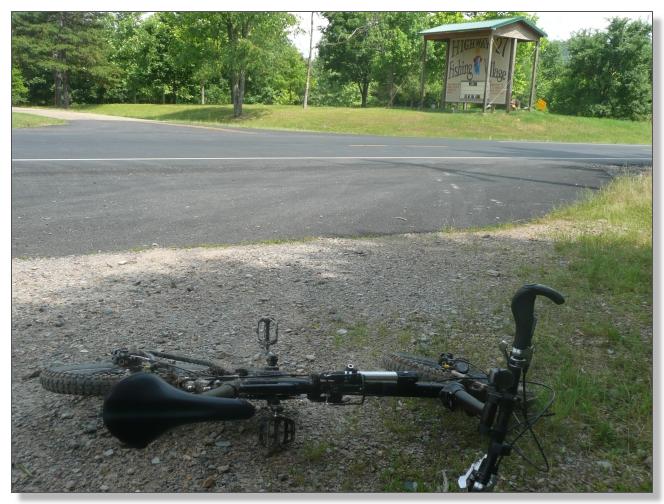
I arrived about 3:15, a few minutes later than nominal but still within the
expected arrival window, and expected Debbie would be happy to see me. Well,
not exactly...
It turns out I hadn't been as clear as I should have been about exactly where
this rendezvous point was, and Debbie had been exploring the backroads trying
to find a trailhead (since none was marked on the highway). She stopped at the
Highway 27 Fishing Village to ask where the trailhead was, and the person
there sent her off on a wild goose chase with vague information about dirt
roads which turned out to be muddy and impassable in my car. So that was
pretty frustrating.
But worse, upon hearing of my itinerary, they wound her up with talk along the
lines of "Oh, that's sure a long, hard ride. The hills around here are
really steep. He's got to be awfully tired. Sure hope he makes it out
alive..."
That sort of help is really not all that helpful.
Anyway, of course I was not dead or anything--I was feeling pretty fresh
actually--but it did make for a more stressful wait than necessary for Debbie
and I felt bad for her having to endure that. She's a treasure.
After that sketchy rendezvous, I decided to change plans a bit and do a
mid-ride shuttle. Loaded the bike into the car, and we drove together to the
northernmost car-accessable trailhead off FR-D75A. From there, I rode
southbound on the Womble back to the now-known meeting spot by the fishing
village. This unconventional scheme did mean that I'd miss the northermost
couple of miles of the Womble, but in the grand scheme of things, it worked
out great.
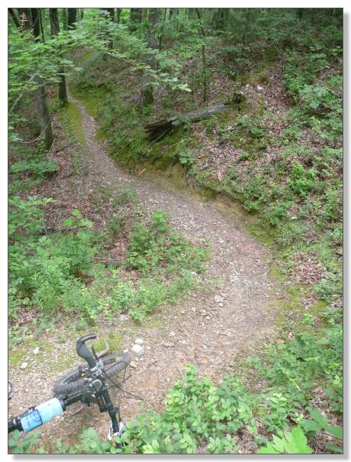
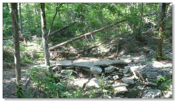
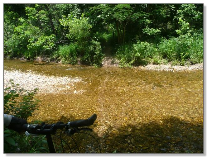
The 9 mile segment of trail north of the lake was notably more "wild" than the
southern 26 miles had been. The narrow, solid, and buff singletrack gave way
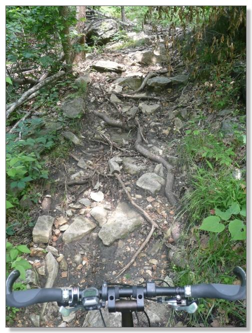
to wider, sloppier, and somewhat technical trail with actual rocks and roots
and such. A little technical challenge was not unwelcome after a day of mostly
groomed, but some spots were too tough to tackle on my 20s at this point in
the ride so I walked a few.
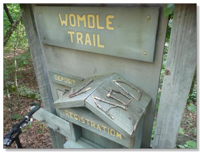
On one of those walks, I spotted a little "WOMBLE TRAIL" Forest Service survey
marker. Then, a mile later, another one. It dawned on me that I had presumably
ridden past 30-something of these things during the day without noticing them.
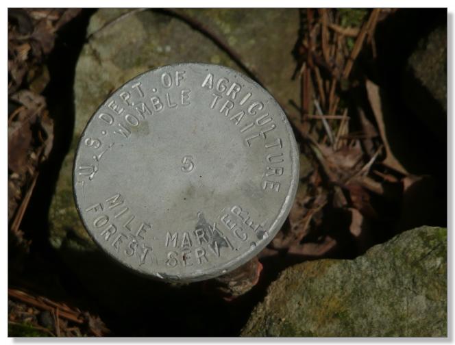
Just beyond the Highway 88 crossing, I finally found a nice "WOMBLE TRAIL"
sign (and registration box). The strange thing was that it was a good 1/4 mile
from the trailhead via a stub trail--basically, in the middle of nowhere. Not
that it matters, but it struck me as an odd way to do things.
The last few miles were a real Jekyll and Hyde affair. The good parts were
among the best of the whole day, namely, a sweet stretch along a bluff
overlooking the lake far below. There was one short but seriously steep and
exposed plunge along the cliff section that triggered the prime directive
(do nothing too stupid) and I walked down. Otherwise, some really cool
riding here.
The ride did end a bit weakly, with the last mile or so being an ugly slog on
sloppy doubletrack and a bit of highway shoulder. I was following arrows that
appeared to mark a recent reroute, so I suspect there's chunk of "real Womble
singletrack" nearby that's under dispute, or rehabilitation, perhaps?
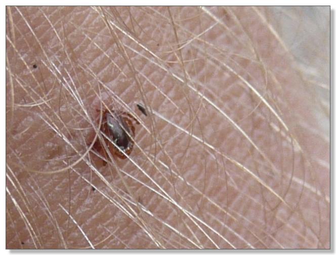
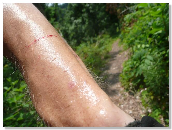
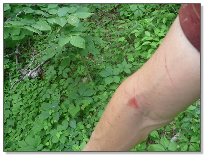
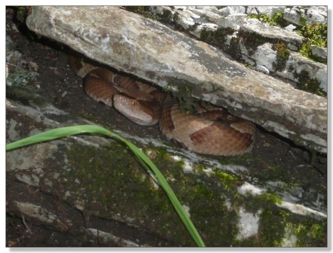
I rolled across the highway bridge at 6:00 and called it a day. Final totals
were 35.72 miles; 5 hours and 11 minutes in motion; and 4.5 ticks (counting
heads accidentally broken off before mastering the tweezer technique--yuk!).
The Womble had lived up to my high expectations. Physically and logistically
challenging. Scenic and remote. Long and varied. Truly a great ride, worthy of
the epic tag and among the best I've done.
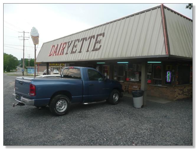
The butterscotch shake from the Dairyette in Mt. Ida put an exclamation point
on it.
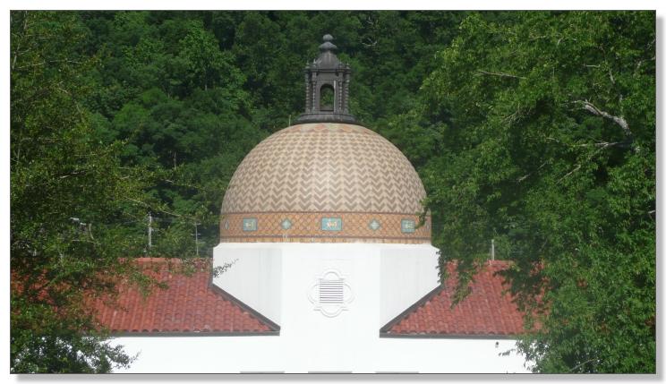
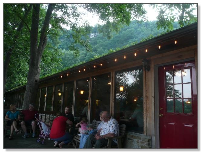
HOT SPRINGS
The next day we did a little touring around Hot Springs and the National Park,
which I'll share just a taste of...
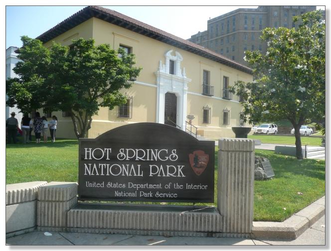
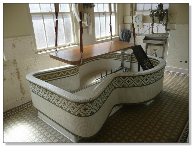
The variety of architectural styles of the historic bathhouses is remarkable.
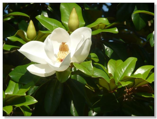
Magnolias galore!
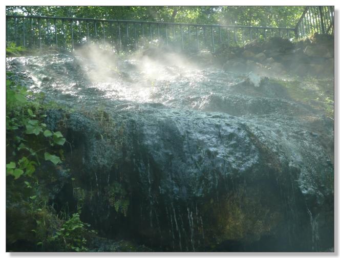
Steaming hot water, at your service.
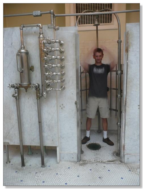
Power shower to blast off any remaining ticks.
They really took their bathing seriously around here.
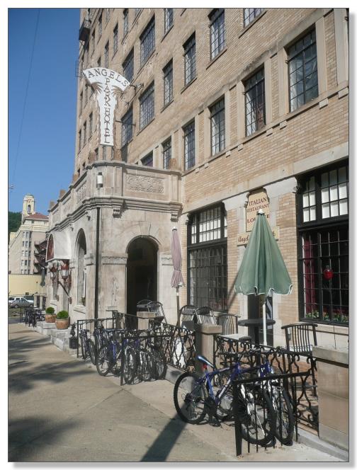
Many bikes seen parked, but few seen ridden.
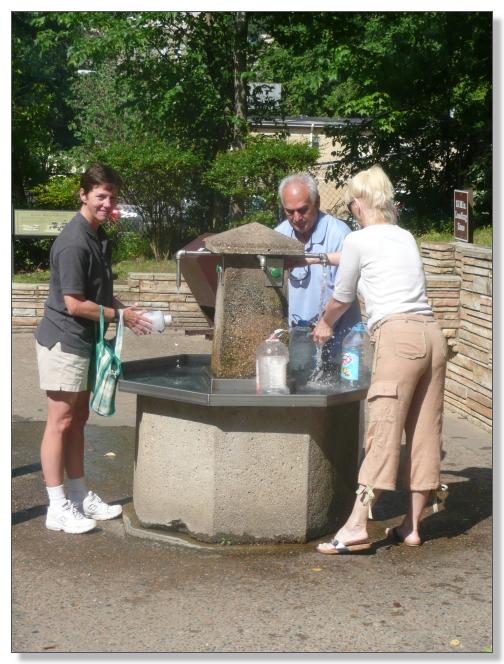
We topped up our bottles with mineral water from the Happy Hollow Spring
before leaving town. Tasty stuff. (and free!)
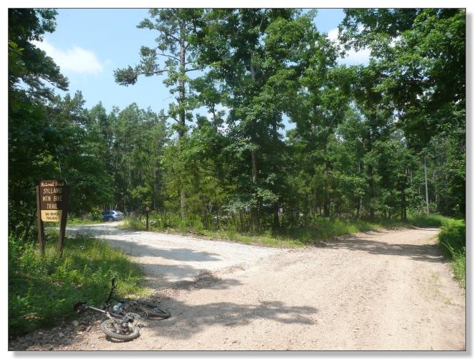
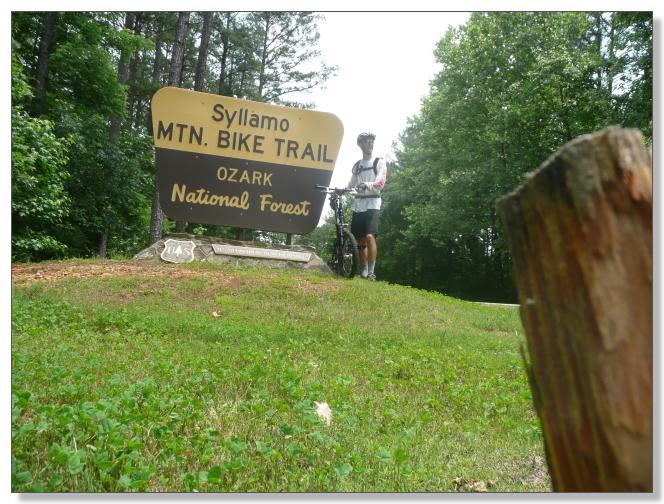
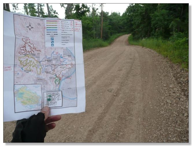
So that's it for the Ouachitas and The Womble. Next up, the Ozarks and Syllamo.

< previous story home next story >
HOME TRAVEL LOG MOUNTAIN BIKING WINDSURFING STORY ARCHIVES RV INFO PHOTOS CONTACT US